
|
Western Tottori, Japan, Earthquake (Mw6.6) | Main | Aftershocks |
| Observations | History | ||
| Research Center for Earthquake Prediction, DPRI, Kyoto University | Links | *JAPANESE* |
*** FIELD OBSERVATIONS ***
- Seismometers -
- GPS -
- Electro-magnetic -
Focal mechanisms show that the mainshock was a strike-slip fault with nodal planes striking northeast and northwest (243 and 153 from Earthquake Research Institute, Univ. of Tokyo, 241 and 152 from the Freesia network, Science and Technology Agency, 330 and 240 from Harvard ). The aftershock distribution is elongated in the northwest-southeast direction, indicating left-lateral faulting on a northwest-southeast striking fault.
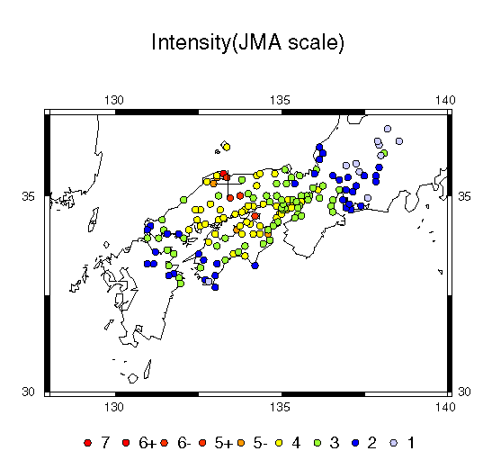
The shaking intensity, as
measured by the JMA scale, had maximum values of 6+ in the vicinity
of the epicenter. The event was felt over a large region of western
Japan with intensity 4 in Kyoto and Kobe, and intensity 3 in Osaka."
The epicenters of aftershocks located by the
Disaster Prevention Research Institute, Kyoto University roughly show a
line that extents for about 25 to 30 km.
There are no reports of large surface rupture , cracks and surface deformation
have been reported at several sites close to the aftershock trend.
There are no large mapped
faults in the region that have the same trend as the aftershocks.
There have been 7 magnitude 4 to 5 earthquakes in this region since 1989 that also occurred on a northwest-southeast trend very close to the aftershocks of the October 6 event.